The Power of the Tackle Hunger Map
How Tackle Hunger is Helping Make Sure Food Charities Have Resources to Feed People.
In 2020, the world was dealing with the uncertainty of COVID-19 and lockdowns. A question arose from the uncertainty: could we find out what food charities need in real time?
That one question led to the newest innovation: the Tackle Hunger Map.
Using our nation-wide connections with food charities and a partnership with Dell Technologies, we got to work. Through the power of artificial intelligence and some key monetary donations, the Souper Bowl of Caring developed the one-of-a-kind national Tackle Hunger Map.
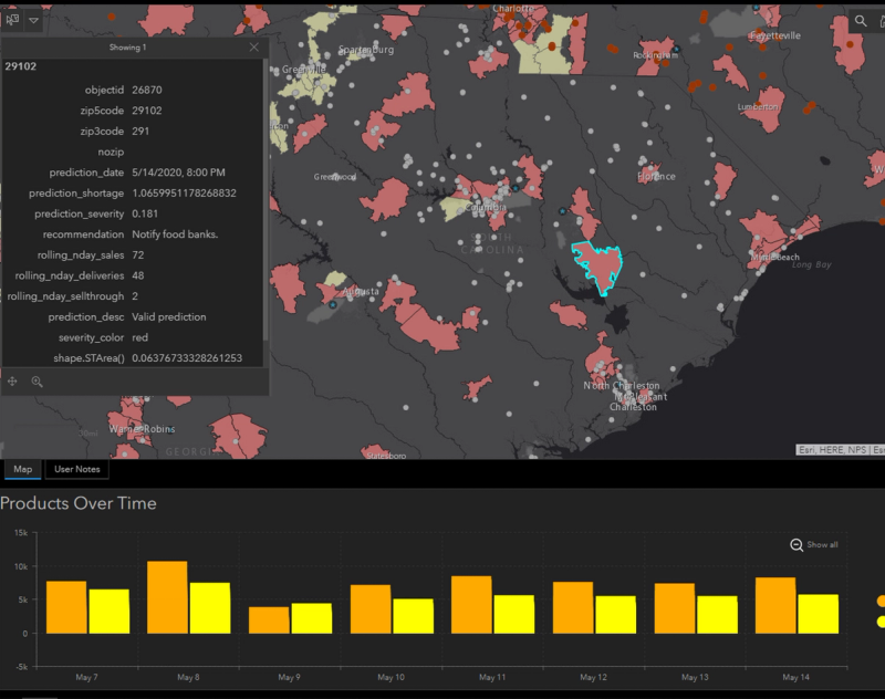
The Tackle Hunger Map shows the locations of local food charities and their real time needs. Groups and individuals can easily become a support network for their local food charity or they can give right through the map. This means that food pantries of all sizes have equitable access to support. Donations given locally, stay local.
The Tackle Hunger Map quickly became a valuable resource for disaster relief with real time tracking of needs and possible disruptions to supply chains. With a glance, it is obvious which food charities have available resources and which ones need assistance. A simple phone call to the charity can make sure people aren't being turned away at a food charity.
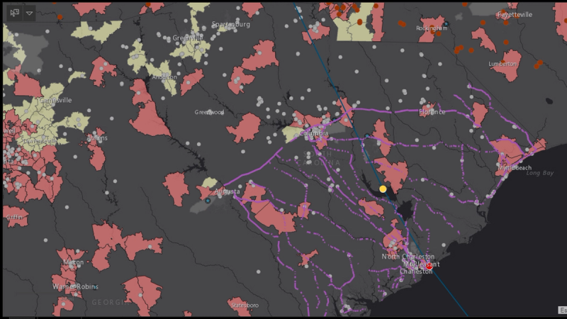
In emergency response and working with the Department of Defense and Northern Command, our map was pivotal in taking response time of getting victims' basic needs met from three weeks to three days. Seeing where food charities are on emergency evacuation routes improve ability to stage critical supplies in appropriate locations for maximum support.
There is no national database of food charities that is being maintained to ensure accuracy. Without this important work being done, we will never know where there are holes in this vital system of support to the 40 million food insecure individuals in our country. Our map will provide that information so we can find creative solutions to be sure everyone has access to quality food.
To donate to our work, click the Donate button in the bottom right hand corner.
We are actively seeking partners in this work. If you are interested, please email Alison Reese at alison@souperbowl.org or call us at 1-800-358-7687.

Examples: